


This website has been archived from TrainWeb.org/utahrails to TrainWeb.US/utahrails.
ROAD TRIP DAY 1.5
GORDON CREEK
BRIDGE
Day 1.5, Friday, 10/12/01
After lunch in Helper it was time to find my next photo shoot location. The reason for the different background is this is all Utah RY stuff shot between the Wildcat Loadout and Gordon Creek Bridge. I have been trying to find a way out there for a long time. Every road was washed out on my previous tries. A 128" wheelbase, two wheel drive PU is not very good on washouts. Last winter Paul, Todd and I tried a new road by the loadout. We came to a wash that was very narrow and deep. There was a partial bridge but looked very shakey. Paul very wisely opted out. Not too good to see the War Wagon with it's nose six feet down, off a bridge into the narrow wash. More on that road later.
I had found some roads located on the west side of the bridge, but were they still there and passable?? With printouts taken from Topo USA 3.0 and a full stomach, headed out Consumers Road to Wildcat Loadout and beyond on the gravel road. After several miles, about eight, I found what looked like the route on the map. Seems this road is being used by the company running a new natural gas line from the area South West of Helper so is in good shape.
No more gravel road but a good dirt one. Headed left off Consumers down and across Gordon's Creek and up the other side. I was hunting for the side road off this one to take me south east as I was heading south west now. After about two and a half miles I came to a "T" in the road. This side road was to the pipeline. Was hoping I could get across.
I got lucky. The road has now became a good trail for a while. About a mile down it started to get rough. It is getting narrow with deep ruts in places. This is the type of place that can junk out a good paint job due to the trees and knock off anything that hangs below the frame.I am lucky here. What paint job. May even put a shine on it. I also have nothing below the frame. As long as I keep from hanging the diffy, I am ok.
It has been over six miles and wonder where the trail splits. Ah, finally found it. I take the right fork as the left one heads east and I want to go south east. Head off down this trail. About the same as the other one so no problems. Finally come to the end of the line, called dropoff and there is the very south end of the bridge. Not the shot I wanted. Select "R" for reverse, not race, and back track. I was one mile from the last turn. After about a quarter mile, still in "R", I found a hint of some tracks heading off to the right.
Now I am really off the beaten track. This trail probably only gets used during hunting season. No big ruts in this one but still rough and a slow go. Finally come to the end where they have installed a wildlife waterer which was bone dry. I could see the edge of the small plateau I was on, Cedar Bench, about a hundred yards ahead and to the right. There was also a spot where someone in the past had cleared some brush and trees. Time to make my own road.
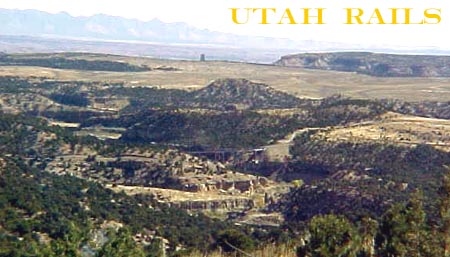
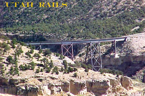
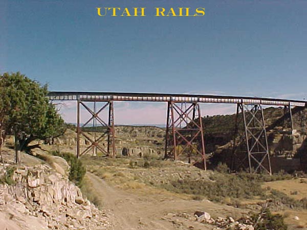
Normally I do not condone making your own road unless it in in a wash or river bottom that will get fixed during the next rain. This area is high grass clumps and not very smooth. Finally make it to the edge before it drops off. Still have short walk to do to the edge. I get to the edge and YES, this is what I wanted. There was the bridge about 7000 yards away and 600 feet below me in the SE direction. I sit down and huff and puff to catch my breath. The only bad thing is the wind is blowing.
Here is what I used for the following pictures. Sony MVC FD73 with a built in 10X optical zoom and a 2X add on lens. This makes it 20X at max zoom. You ask what is 20X?? Well at that setting the bridge that is 7000 yards away looks like it is 350 yards at full zoom. If you think in terms of a rifle target scope, you get my drift. Just don't shake when you snap the shutter. Did I have a tripod?? Nope, just the shakes.
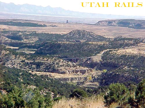
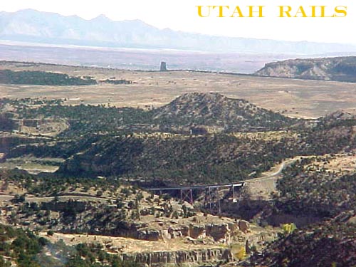
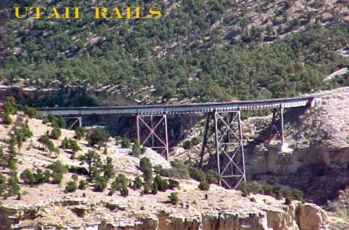
I am going to start off at about 3X zoom and go from there. Enjoy.
Was it worth it?? I think so. I gained a shine on the paint job. The bad, I lost my antenna. Ok, now for the rest of the story. On the way back to the paved road, I came around a corner about a mile west of Wildcat and lo and behold, there was a brand new 4X4 off the side of the road. It was resting vertical on the bank, nose up and on it's top. Four wheels in the air like a dead fly. A gal was driving it and OK, just shook up and was on the cell phone trying to explain to Hubby why his new truck was totaled. From the marks on the road, she came flying around the corner heading west, lost it and tried to correct. That is the problem with these new fangled wanna be trucks. You combine a high center of gravity with a passenger car ride, you end up like a dead fly.
On with the story. Stopped at Wildcat to get a picture of a rare X-buck. How many do you see that are black with white lettering. You do on the UTAH.
At Night.
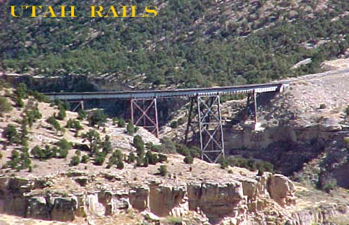
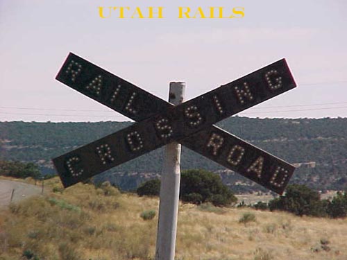
While in the area, I decided to check out the road that had foiled us last winter. Turned off of the pavement, stopped and said what is this. Seems the pipeline company needed a road into the area. What used to be a trail was now a freeway. Gravel road, new bridges, new RR crossing and the works. Ran down the new freeway to the bridge, last 100 yards not very good road. Here it is with no zoom. Note: The road past the bridge is posted. I kind of wanted to check out the old town site of Gordon Creek.
Wildcat Loadout from the south.

On the way down to the bridge I ran into a hi-railer heading to Hiawatha. Now I know why. They were going to make a six unit light move down to pick up a loaded train. Would have been nice to see. They were called for 1630 for the run. Track speed for the run was 5MPH for the full 21.4 miles. Would have been hard to get pictures.
This ends day 1.5 as I had been up for over 24 hours and time to crash.
Day 1.5
Day 2
![]()
![]()