Eritrean
Railway & Ropeway

Massawa
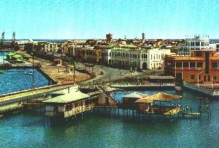
Postcard courtesty of Charles Moulton
The above picture was taken some time between 1963 and 1970.
Click on the picture for a full view. It shows Ethiopian bunting on the
lamp post.
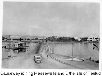
Photo courtesy of Jerry Pry
This picture from Jerry Pry was likely taken during the '30s or '40s.
It shows the opposite view as the one which Chuck Moulton had. The
little building on the left could not be remembered by either Chuck nor
myself. It seems interesting that it had to have been there during
both our tours and neither of us remembered it. From a picture I
found on Merbat Tzehai's site, the building is not there today:
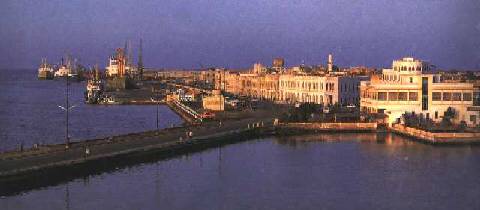
Photo courtesy of Hans van der Splinter
In the picture from Hans and Merbat, the commercial docks are on the
left. Chuck Moulton took several pictures of this area. I have
a dock area page.
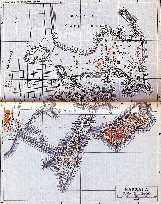
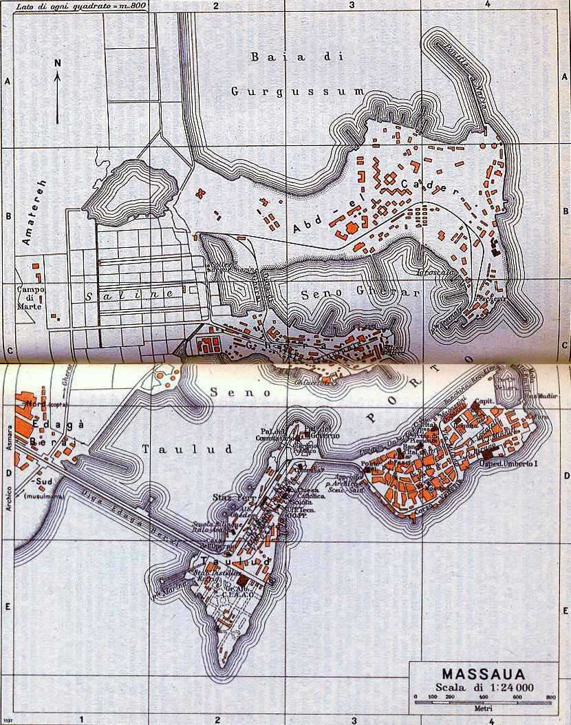
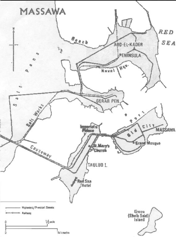
Map courtesy of Renato Gaudio
Renato Gaudio and
Jerry Pry have each provided a map of Massawa. Renato's provides
quite a bit of details and Jerry's will load much faster. Both show that
the city consists of two islands. The main part of the city
is located on.Massawa Island. It holds many buildings from the Ottoman
era. The Isle of Taulud is where the C.I.A.A.O.
Hotel was located. Renato's map shows this. There was a
palace on Taulud. It is in ruins today.

Photo courtesy of Daniel Berhame
In the foreground, between the trees and the road, there is a dark
line. I believe that this is the railway. It is in the right place.
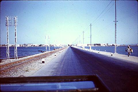
Tom Johnson took a picture from a car on both causeways. The first
of these has the camera pointed at the Island of Massawa. Notice
that during Tom Johnson and my time at Kagnew Stations the cars drove on
the left hand side of the road. By the time Chuck Moulton arrived, they
were on the right (see fourth picture below).
The second of these is taken on the causeway between the Mainland and
Taulud.
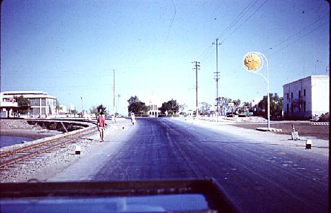
Saint Mary's Coptic curch is straight ahead. In spite of the
Arabic script, most people recognize the gas station as Shell. On
the left is one of the small stations or shelters taken by Paolo Gadignani.
Photograph
from Paolo Gadignani
Massawa,
Asmara,Eritrea
Resti
della ferrovia costruita dagli Italiani.
This picture was taken recently. Initially, I believed this
was the station from which I left the Littorina in 1961, which I mentioned
in my narative about a trip from Asmara to Massawa.
However, in retrospect, it is of similar architecture, but the one in Tom
Johnson's picture is the real station.
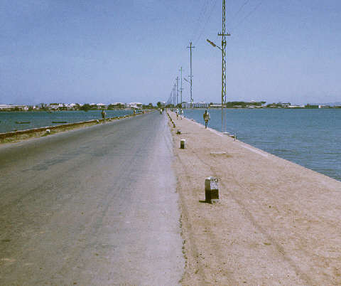
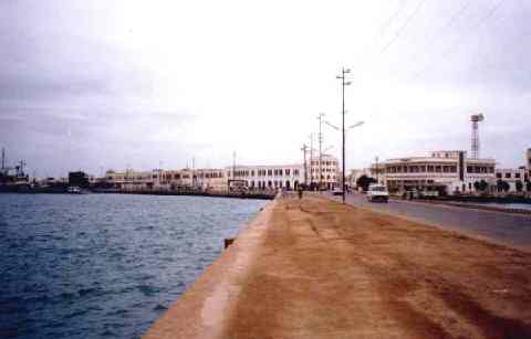
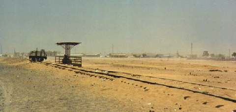
Photo courtesy of Dave Engstrom.
This picture was taken recently by Dave. I know they have completed
the rail system around Massawa. Perhaps it runs down the other side
of the causeway.
Photograph Courtesy of Joe Zeibel
After I left Kagnew Station, the Army built a new Rest Center near
the causeway between the Island of Massawa and the Island of Taulou.
The top picture is at the other end of the causeway, to the right of the
camera in Joe's picture. Jerry's picture was taken to the left of
the camera.
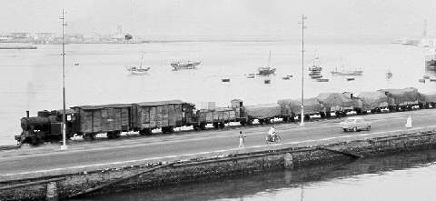
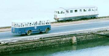
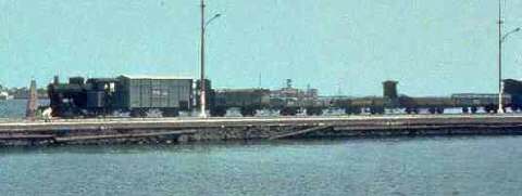
Photos courtesy
of Chuck Moulton
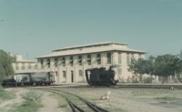
Photo courtesy of Dennis and Maria Horner


